Saturday, November 28, 2009

I have not been to Vancouver Island for quite a few years now, and it was time!
I had hoped to spend a couple of weeks in the area, but my 'navigator' and her cat were available for a shorter time, so we made it a quick trip.

We drove as far as Revelstoke the first night after work, ate at a restaurant with a friend from there, and camped in his driveway.

Then, it was off for the coast the next day, still pleased with the fact that there are no more tolls on the Coquihalla highway. It was a stat holiday, so the drive through Vancouver was not bad at all. After a quick visit in North Van, we caught the last ferry from Horseshoe Bay to Nanaimo, and found a roadside spot to sleep near Nanoose.

From there it was on up the island past Courtenay (soon to be flooded) and Campbell River.
We had hoped to have a good look around Telegraph Cove, but it was dark when we got there and pretty much deserted, but we walked the boardwalks and enjoyed the sea breeze.

From there we caught the Port McNeill ferry to Malcolm Island - and the town of Sointula, of Finnish origin (that of my navigator).

We located a nice, deserted campground on the north shore of the island. The heavy bush provided some protection from the wind, but we enjoyed the sound of the rain on the roof at night, knowing that all the snow and ice was finally melted from the truck and camper.

From the forecast, we had expected and were prepared for nothing but rain, but were pleased that the sun made occasional appearances.
A few locals came to walk their dogs in the morning, but otherwise, we had the place all to ourselves.

We toured the island a bit, making the locals wonder what us 'tourists' could possibly be doing here at this time of year!
We had missed the early ferry, so continued the tour out towards a lighthouse on the west end of the island.
As usual, the cat was waiting for us to get back.

Sometimes she preferred to ride in the back of the camper, but it was a bit cool, so she snuggled under the blankets to stay warm.
Then, it was a long drive down the island to Victoria, at the southern tip. The new island highway is four lane much of the way now, so it is a lot faster than it used to be, but south of Nanaimo it is slow going.
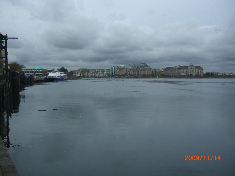
We checked out the waterfront.
And toured the Undersea Gardens ...
And drove by the Empress Hotel,
opting to have our 'afternoon tea' elsewhere. We also toured the Craigdarroch Castle, but I guess I neglected to take photos!
We took the Saturday evening ferry back to the mainland, and drove to Hope to spnd the night before tackling the snow and slush on the way home.
Nevertheless, it did snow a bit overnight, as you can see where we stopped to look at the Othello Tunnels.

Unfortunately, they had closure signs up, warnng of the hazards of falling snow, ice and rocks.So, with 4 wheel drive engaged, we slushed it back up and over the Coquihalla, and Roger's Pass on the way back home.

Sunday, November 22, 2009

Heading south on the Cassiar Highway eventually brought us to the junction with Highway 16, running east and west. My Roger's cell phone came back to life - finding it's first reception since we left Alaska!

Back on dependable pavement again, I spent quite a while at the car was - hosing off the last of the Yukon, Alaska, and northern BC mud.

The weather was warm again, at 23C. No decent camp spots were located in the Burns Lake area, but we did finally pull into Beaumont Provincial Park to spend the next night. Weather had been dry and a fire ban was still in effect.

I found a glass repair shop in Vanderhoof, but as I suspected, the cracks were too big to be repaired. Now it just a case of sitting back and see where the cracks spread to and how far they go before a new windshield is in order.
It was a pleasant, though somewhat uneventfull drive on east through Prince George on this Monday morning, and before long we were getting back near my old stomping grounds of Jasper.

Just west of Jasper park is Mount Robson Provincial Park, with the mountain of that name - highest in the Canadian Rockies at 12, 972 feet - seen below. It is usually covered in clouds, but in this shot, only the very tip is covered.

We crossed the last boundary of the trip back into Alberta and into Jasper National Park. Some serious rock work was in progress along the side of the road.
After turning south onto Highway 93 (Icefields Parkway) at Jasper townsite, it was now only a short 230km trip back home. My 'residents pass' saved me from having to pay the park fees as I headed south. Near Mt Kerkeslin, where I used to live about 15 years ago, the usual mountain goats were along the side of the road at a mineral lick, creating the usual 'goat jam'.
There were a few goats and kids enjoying the lick.
Shortly after 6pm I pulled into the driveway at home in Lake Louise after a trip of 10,546 km, not including distances traveled on the ferry.
We had departed the same location on July 24th, and it was now August 17th!

Fuel prices ranged as high as $1.34/Litre at the juction of the Dempster highway, to a low of $.82 in Hinton on the very first fill of the trip - even though there was a fuel shortage at the time. All prices for diesel fuel.
The furthest point west reached was near Anchor Point Alaska, south of Anchorage at:
59°47'54.28"N 151°50'25.21"W.

The furthest northern point we reached was a days travel up the Dempster highway at: 64 53.398 N 138 16.861 W

The furthest southerly and the furthest east points were at the starting and ending location.

Though this trip took place between July 24 and August 17, 2009, it was not possible or convenient to blog it in real time - partially due to time and internet constraints. Surprisingly, it has taken me until late November to complete this trip after the fact.

While I find myself at home shoveling snow at present, I hope to be able to depart very soon for southern climes to get the acumulating snow melted off the camper and the truck.

I did in fact make a short trip out to Vancouver Island last week - just before the storms and flooding hit. I did take a few photos, so I may post those next time - before I head south!
Hope you have enjoyed our Yukon/Alaska/northern BC adventure, I know I did!

Thursday, November 19, 2009

Heading south from Dease Lake on the Cassiar Highway, we passed by Mt Edziza Provincial Park, home of the highest volcano in Canada at 2,787 m (9,144 ft).We also went by the Spatsizi Plateau Wilderness Park, but time was short and there was no time to stop and explore. We'll have to save that for the next trip up here.
Along Kinaskin Lake there was a nice little rest area that looked like a good spot to spend the night, along with a couple of other RV's - including one that had camped next to me the previous night up along Dease Lake.
There was a good supply of dry wood along the lakeshore, so an evening campfire was in order.
I did make a quick stop at a National Hisoric Site - Fort Kitwanga.

Kitwanga Fort
Located in Kitwanga is the Kitwanga Fort a National Historic Site of Canada. The Kitwanga Fort is associated to the aboriginal warrior Nekt in the 18th century. Nekt strategically located the fort on Ta'awdzep or Battle Hill to have a vantage point over the adjacent Kitwankul Trail and the Kitwanga River Valley.


The fort was built on top of this hill. There are stairs and a trail leading over to the hill top.
This is the view from the hill looking back towards the road.
And, down to the river that the fort overlooks.


Inevitably, there was road construction along the way south, just to ensure that the truck kept a good layer of dirt on it!
I got a kick out of the signs along the road near Hazelton - New Hazelton.
You might too! For the 'Ksan Campground


Good one!

Tuesday, November 17, 2009

On the way down the Stewart-Cassiar Highway #37, I had camped along the side of Dease Lake.

At the town of the same name, there is a spur road leadingwest to Telegraph Creek - about 100km. I had it on good authority that the road was worth a look.
The weather was a bit mixed, but I thought I would give it a try. The first 60km or so was through the bush and fairly mundane, but then the road dropped into the canyon and followed the river the rest of the way to Telegraph Creek.
I think this was a seasonal native fishing village along the way.
Only one of these shacks appeared to be used a this time.
The river has cut a deep canyon.
The road winds back and forth, up and down, sometimes carved out of the cliff.
Sometimes well above the water, and sometimes very close.
The riverboats could only make it as far as Telegraph Creek, and could not navigate these sections.


Had to jump out of the truck to look over the bank in a spot or two.
Finally reached the village of Telegraph Creek - right down on the river bank.
A lot of the buildings are old and abandoned, but there are a few businesses and quite a number of people living here.
Traffic was light ...
Even some 'turn of century' buildings are even sporting satellite dishes.
Heading back out.
Some places you prefer not to meet other vehicles.

Some places you want to concentrate on your driving!
No guardrails here.
Heading back out to Dease Lake and continuing south on the Cassiar from there.
The month - long trip is winding down as we get back closer to 'civilization'. Still not wearing a wristwatch! Filled the tank again in Dease Lake at $1.11 for diesel, and headed on south.