Monday, August 28, 2006


Still haven't tried out Google Earth?
What are you waiting for?
(Unless you have dial-up; sorry)


Here is a good introduction story about this great (free) program.
http://www.slate.com/id/2148229/nav/tap1/
http://earth.google.com

Sunday, August 27, 2006


Back at work for a few days, and the bears are keeping everyone on their toes because lot of them are down in the valley bottoms and roadside trying to get fat for the winter.
A few years ago we had a float plane go down in the park, suffering from a blown engine. The pilot made a remarkable landing on the gravel flats with the floats, and walked away from it. Just a couple days ago, another plane was reported down, and we went in and picked up the pilot, who was fortunate to be unhurt as well. (Plane id's removed to protect privacy) At least it was a beautiful day for a plane crash. We had the lat long's of the downed plane, so finding it was easy - especially with the Google Earth map I printed out to take along as reference.
Today, in an unrelated test project, I have been monitoring a colleague's field locations all day via the internet. The gps-enabled transmitter sends it's locations to satellite at regular intervals, and that location can be monitored online and mapped using Google Earth or Google Maps or Ozi Explorer. Pretty cool technology!

Tuesday, August 22, 2006


On Saturday we headed further north up the valley to see what it had to offer.
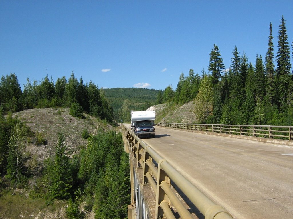
Halfway up the road detours about 5km to the east, to go around the Downie creek arm of the lake.
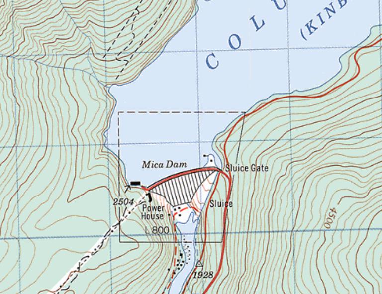
Then Gold Stream and finally, in the middle of nowwhere is Mica Creek - which is the remains of the dam construction camp, but still inhabited by BC Hydro employees who work around the dam. They even have a mess hall where you can get meals (at meal times), but I did not test the fare. I did discover some wi-fi, tho, which enabled me to post the previous update! The dam is pretty impressive and is one of the largest earth-fill dams you'll see and is 670 feet high! It was completed in 1976 and created Kinbasket lake, stretching 216 km from Valemount in the north to Donald Station in the south, and covers 427 square kilometres.
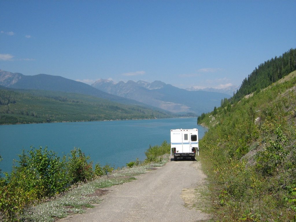
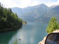
Almost immediately below the dam is the start of Revelstoke lake - which runs 150km to the south, ending at Revelstoke (dam).
The paved road ends right at the dam, but I checked out a couple of Forestry rec sites just a ways further up the road.
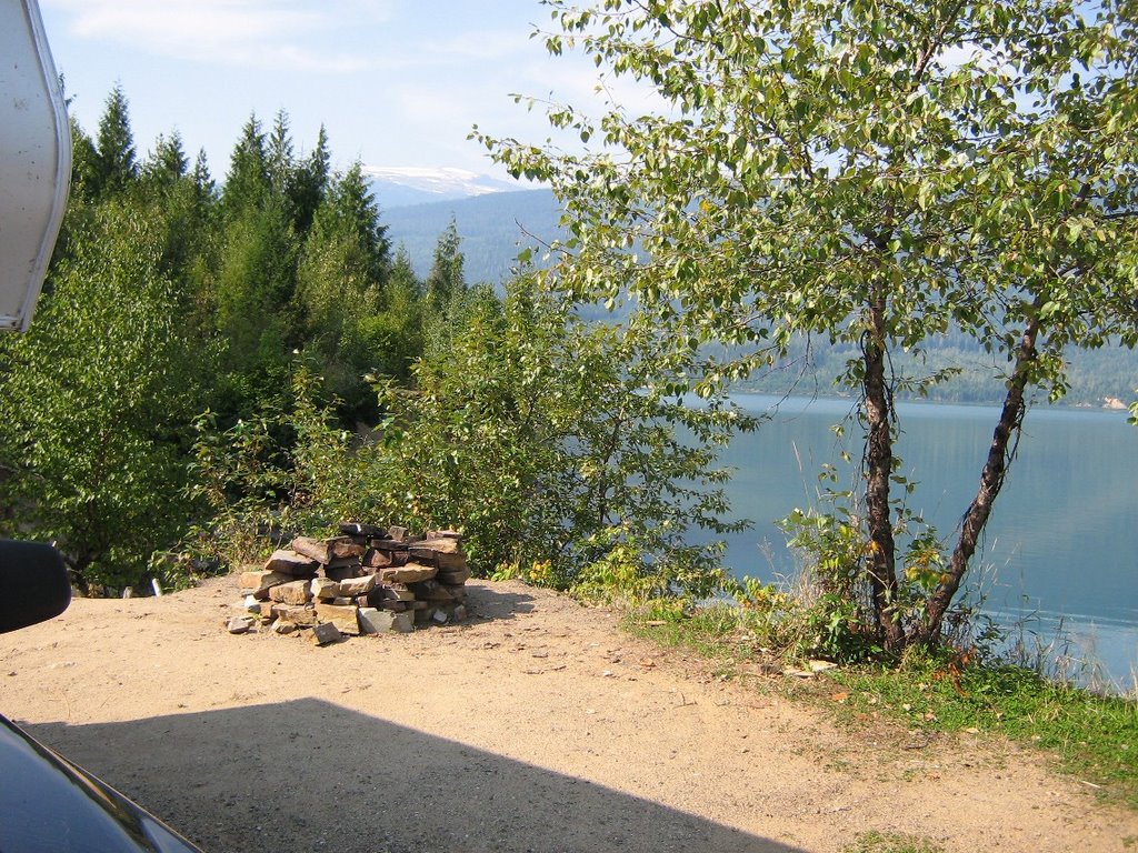
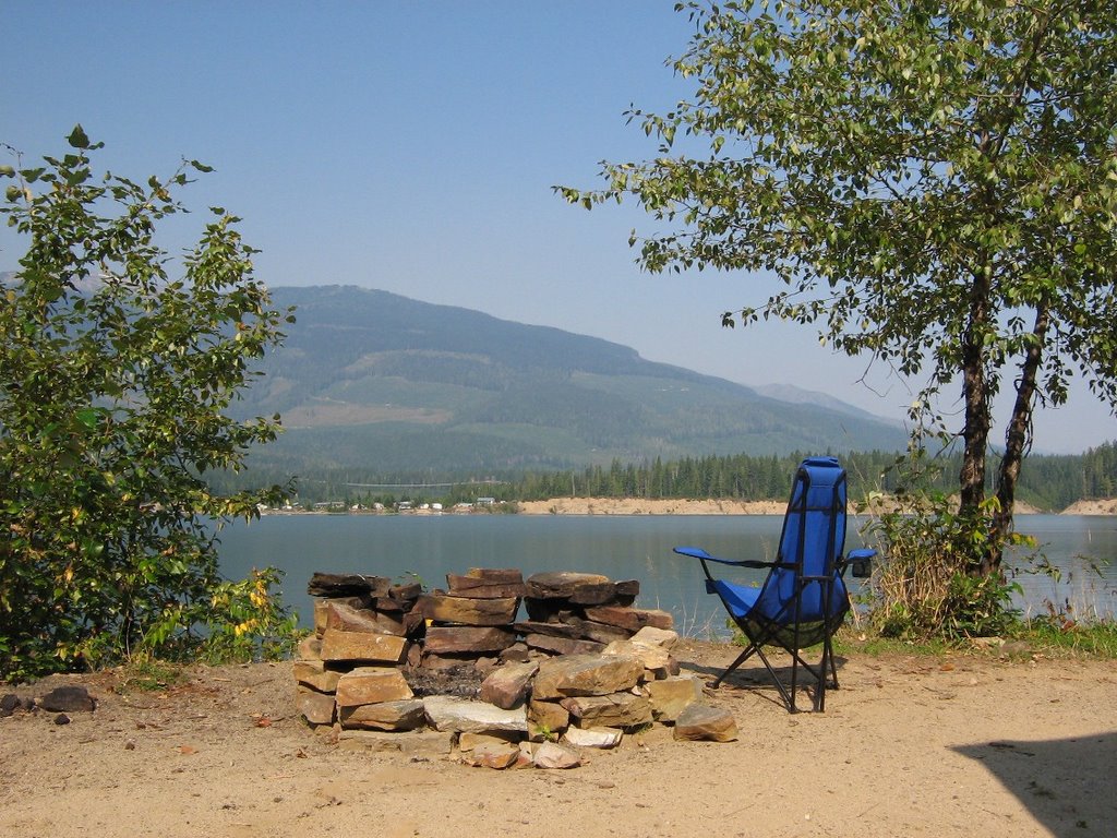
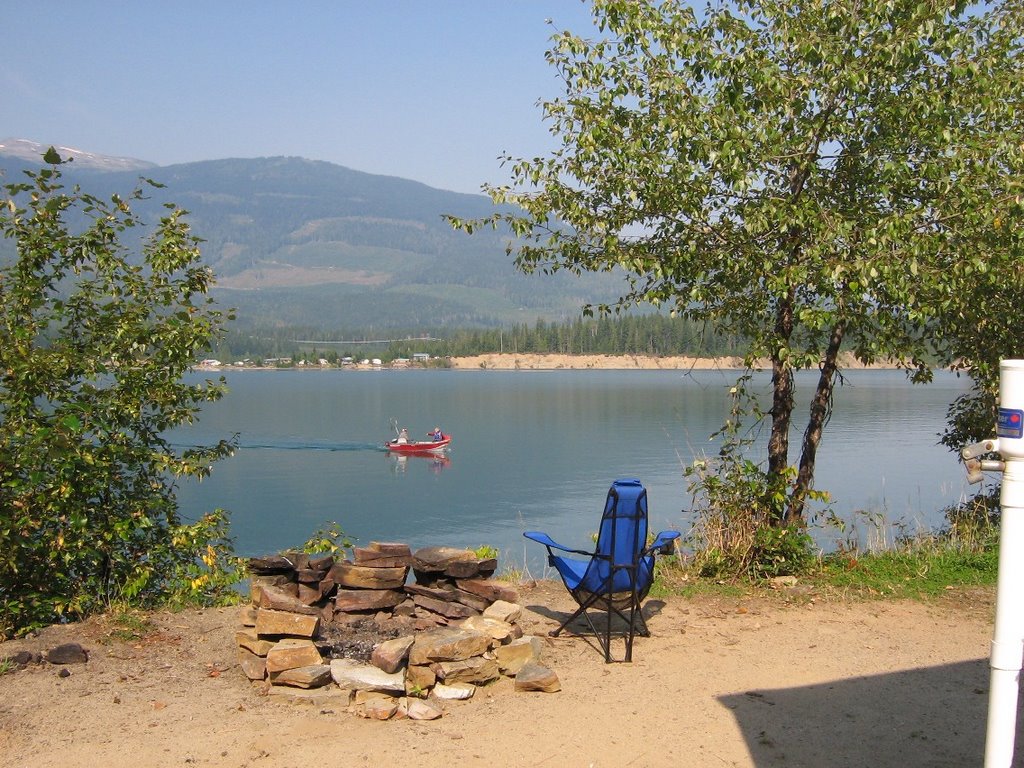
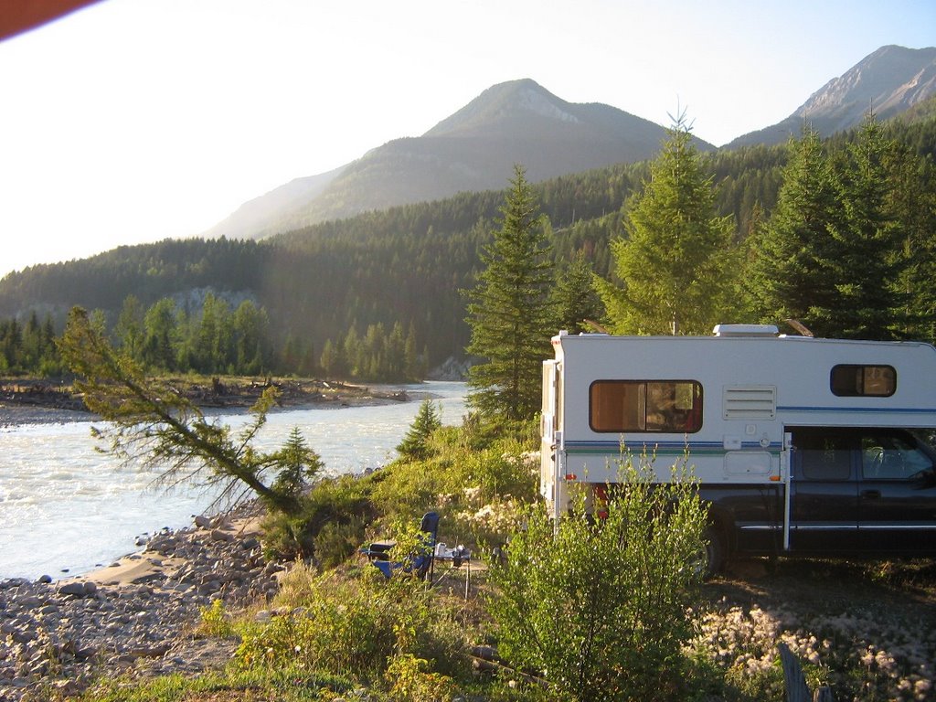
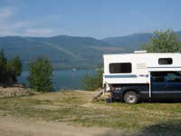
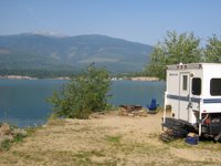
They weren't that great, so I headed back south and eventually selected a free site on the south side of Downie arm.
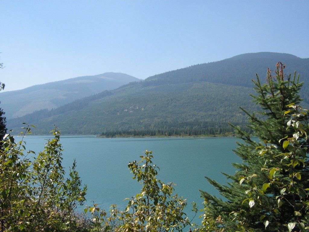
It was a nice site, with 180 degree view of the water and a nice little sandy beach. Only a few fishermen were camped nearby.
Had a nice campfire overlooking the lake and listened to some owls hooting in the woods behind. Strangely, have not seen a loon on this lake despite an apparent abundance of fish. Saw a family of merganzers at Carnes Ck, but that's it.
Perhaps the banks are to steep for nesting, but sure missed hearing their calls. Even though the traffic on the road was strangely quiet even for a sunny weekend in the summer, that ended sometime after midnight on Sunday! Not sure if it was Hydro staff getting back to work in
time for Monday morning, or logging crews resuming (likely both), but after midnight, the road got quite busy, which didn't do much for the serenity of the area! Them's the breaks, I guess! Another lazy blue-sky day on Monday.

Saturday, August 19, 2006


I know it is only for an extended weekend, but it sure feels good to get back on the road again, hey Harley! Had another 5 days off to kill, so pulled out the old maps to find somewhere interesting to go. Decided that since I had never been up north of Revelstoke, and the map looked interesting, the weather good, it would be just the time to check it out. Quick stop at Tim Horton's in Golden on the way. The road (highway #23, actually) runs right along the side of Revelstoke Lake for almost 150km, and I was pretty sure it would be paved. Sure enough, the road was in great shape, and yes, it was paved! And the traffic! Well, about 2 vehicles per hour was it! And lots of very nice Forest Service rec sites along the way, as well as Martha Creek Provincial Park. Martha Creek was full, but was way too busy anyway. Settled in to a beautiful 'view' site in Carnes creek rec site. At $10. you could afford to stay all month. A few families were there as well as quite a few anglers who were trying their luck in a number of small boats. A beautiful sunset, and a full view of the southern sky in case the satellite dish wanted to fire up Sat by the fire till the stars were shining bright.

Wednesday, August 2, 2006


Well, well, hasn't it been a while? January thru March when I was on the road (my favourite place), I was always going somewhere, doing something and taking pictures to show you.

Since then, I have been back at work, still going places and doing things - and taking pictures, but just never seem to have the time or inclination to post anything. Also a little concerned with privacy of some of the folks I deal with at work, and wanting to be careful not to P.O. the employer by saying things that may be, well, less than complimentary!
But now, here we are in August and summer is over. Well at least the heat spell is over and the mountain tops have received a dusting of snow, to let us know that our very short summer is winding down - and that we should begin planning the expedition for this season!

Even so, the camper has been busy, and we have been out lots, but usually close to home because of the fuel prices. Did spend a week at the Merrit Mountain Music Festival (http://www.mountainfest.com/) where we met up with friends new and old.
Harley was a hit as usual, and I fenced in the area under the camper for him so he had lots of shade, and was free to visit with his 'fans' walking by the campsite