Saturday, October 31, 2009

Most places we visited  in the Yukon were very interesting in an eclectic and historic sense, and Keno City did not disappoint.
Keno City was one of the largest producers of Silver in the world and it predates the Gold Rush at the turn of the last century.


Silver was shipped out on sternwheelers suchs as the 'Keno' which we visited in Dawson City.
Now the town is rather small, with a population of 20.  The population apparently mushroomed to this level with the arrival of some artists in town.  There are no stores or fuel available, but there is a restaurant and a very well done museum.
This old gas pump was left over from the past.  It looks like the price wa 79 cents a gallon!
I wish they were open today!


Among the mostly historic facets of town, there are some modern telecommunication facilities as well.


This house below is surrounded by 32,000 empty beer bottles.  The owner of the hotel owns it and used the bottles as there was no refundable bottles in those days.  You can read more about it on the Keno web page.


It looks like there is still the possibility of confusion with the Keno City Fire Dept.  Seems like many long years ago they responded to a burning bank in neighbouring Elsa with their new fire truck - which had no water in it!


Remember Gulf gas stations?


A couple of partners apparenly built these adjoining cabins - just in case they decided to split up ...!


As well as the Keno City museum, there are many other historical displays, including this building which displays early mining equipment, among other things.


Town was busy the day we were there. There was at least two other vehicles around. We were lucky to find parking spaces!

Friday, October 30, 2009


After our hike up Grizzly Creek on the Dempster highway, we headed south to the junction with the Klondike Highway.  Klondike River Lodge is at the jucntion of the Dempster and the Klondike highway. There is a gas station and campground there so we took advantage of the opportunity to dump one tank at the campground, and fill the other - at the gas pumps.


Time was a concern and we wanted to put a few miles behind us before the next day's visit to Mayo, Elsa, and Keno City.  We kept on trucking past Stewart Crossing and turned north west onto the Silver Highway.  This appeared to be a very quiet road, so once again, we just parked in a pulloff on the side of the road and began supper preparations.


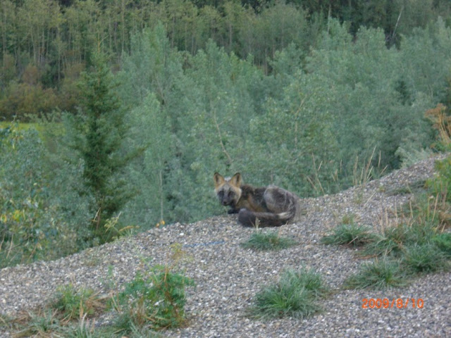
While standing looking over the edge of the road I saw a small movement - there was some sort of animal down there!  My camera was on my belt, where it always is, so I moved quickly to get it out in case a photo was possible.

Well, it turns out that stealth was not really a requirement with the little fox that appeared out of the ditch.
It became obvious that he was not at all afraid, and might actually have been looking for a handout!

He certianly wasn't going to get a handout from us, but he hung around for quite a while, perhaps hoping.
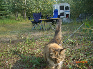
The cat was very interested, but decided that she would forego an evening stroll for now!
In case one was worried that the little guy was dependent on handouts for his meals, he dispelled that theory shortly by showing off a fat gopher he caught a few minutes later.
 
In the morning we continued a short way up the Silver highway to Mayo and toured the small town extensively, reading a brochure about the history of almost every house and building.

Further up the road was the abandoned (ghost?) town of Elsa.  It was a strange mixture of old and modern.
The majority of the facilities appeared to be from early in the century - and abandoned.
But there was also some modern mining activity taking place.

We drove through the old buildings and roads taking a few photos.
Maybe we came in the back way and did not see the Trespassing signs!


After Elsa, the end of the road was Keno City.


One thing I noticed on quite a number of roads in  Alaska and Yukon is what appeared to be electrical wires at culverts crossing under the road or highway.
My theory (and I think I am right) is that it is a technique to help thaw the culverts in the spring and let the flood waters get through.  There are these electrical plugs on posts that must be hooked to a mobile generator for a few minutes to melt a channel?

Tuesday, October 27, 2009

After a very rainy night camped just off the Dempster highway north of Tombstone Territorial Park, the weather had cleared somewhat, and the rain may have helped dissipate the smoke.

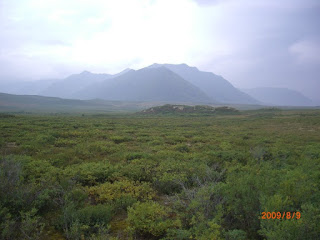
Even in August you could see that the tops of the mountains had received light dustings of snow. Fall comes early up here.
We had turned around yesterday at the most northerly point we traveled on the Dempster
(64 53.398 -138 16.861)

As we headed south, somewhat reluctantly, we were at least able to see many of the mountains and valleys that have been obsured the day before.


We passed by an outfitters camp, likely preparing for sheep season hunts?


On the south edge of the Territorial Park, we chose the Grizzly Creek trail to have a look at the scenery from higher up. For the first time on the trip - because it was a nice sunny day, I broke out the solar panel and let the camper batteries soak up the sun while we were out hiking.
Click on the map below (or any photo) for a larger view.
The trail starts in heavy timber and gradually climbs out of the trees along the ridge.

With some nice views back down into the valley and the Dempster highway.
Looking further up the ridge towards a small lake, and a campground at the head of the trail.


Back to the parking lot and a bite to eat, we were soon headed south again - enjoying the clear skies and lack of smoke finally!

The Dempster highway sign at the start of the road north to Inuvik.


(I tried the 'new' blogger editor this time, which promises many new features and more flexibility, but I found it totally frustrating and thus finished this post with the old editor - thus the somewhat confusing arrangements)

Monday, October 26, 2009

We were still in Dawson City for another day and passed the time with tours of the famous authors houses (see previous post),
and the Palace Grand Theatre.
When it was time for lunch, we came across a secluded little spot on the river bank, near the ferry crossing. The traveling cat got out to check the area while the meal was cooking.
The area called for a glass of wine or two to be served with dinner.
We watched as an evening cruise of the paddle wheeler went downstream,
before fighting it's way back up against the current.
Then it was off to Diamond Tooth Gerties to watch the evening show and one of us tried a bit of blackjack at the tables.
Before it was dark we set out for the Dempster highway and found a non-descript abandoned gravel pit for a quiet place to spend the night. N 64 04.404 W 138 31.681
Even this place had some historical artifacts laying around to explore.
Next day dawned cool and smoky again as we headed north up the Dempster.
It was quite a change from earlier in the trip where we were in shorts and sandals - even taking the sandals off while driving and only using the A/C when we needed a break from the sound of the windows down.
Now, we were wondering if we had an heavy jackets or long underwear packed!
We looked for pingos as we drove north of Tombstone Territorial Park. And the smoke had started to clear just a bit.
Zero moose were seen at Two Moose Lake viewpoint!
As evening approached, we located a nice streamside spot to camp for the night. Another truck camper moved in later to share the scenery, but there was lots to go around.
N 64 42.921 W 138 22.647
The 'navigator' decided the camper needed a little decoration, so she hung up this inverted bouquet of roadside flowers and plants!
It rained most of the night, so we hunkered down, played some cribbage (I'm lousy), and watched a movie.
In the morning, we would hike up Grizzly creek trail if the weather cooperated.