


I like this idea of getting long weekends every second week! I had a few options in mind for the long weekend, but family considerations trumped the others this weekend. I left a day early and drove down through Cranbrook and almost to Yahk. Had been out early in the morning mountain biking and hiking in 6" of fresh snow in the mountains, looking for a missing hiker, so when I found a quiet rest stop off the highway, it didn't take much convincing to stop for the night. Next morning through Creston and the Salmo-Creston summit and Kootenay Pass (1774m), however high that was - I think it was around 5600'! Then on in to Trail - where I used to work briefly, many years ago, and to Rossland - home of Red Mountain and a flurry of extreme condo development.
I travelled north from Kaslo, BC on highway 31. Well, highway #31 is pretty interesting - for a numbered provincial highway! Even in the Kaslo area, it is not that wide as it follows along between the frequent cliff faces and the lake. It is very scenic, though, and there are several provincial campgrounds along the way. Once past Meadow Creek, however the road becomes essentially a gravel logging road, in many places barely one lane with no speed signs, curve signs or warnings other than 'no services' ahead.
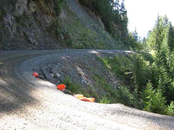
While the road is not nearly as rough as some I described in Mexico (see Feb 2006), there are some weird similarities. I was puttering along at about 60km/hr when I came to a construction ahead sign with a 70km/hr speed limit! I resisted the urge to speed up to comply with the limit, but then I found that all work had stopped for the weekend. The true safe speed through the construction zone - which was repairing sections of the road washed out by the Lardeau river - was about 20km/hr. The road was posted with warning signs that specified the proper radio frequency (166.080) to use to avoid getting run over by logging trucks. This is kind of strange on a provincial highway, but totally expected on an active logging road. Since there was no log hauling evident, I did not bother digging out my 2-way radio, but I wondered what the average tourist was expected to do? Unlike the 'safety boulders' used so efficiently and effectively in Mexico, the BC method of marking hazards is positively high-tech. Orange plastic bags with some sand in the bottom. That's it!
My last attempt at getting online had been at Ainsworth Hot Springs, but my mouse was acting up, or so I thought, so I gave up trying. Also found some signal in Trout Lake, but did not realize at the time that all the USB ports on my HP Pavilion dv8000 notebook had malfunctioned, and I was trying to use a USB wi-fi adapter instead of the built-in one. Unfazed (well, not really), I carried on towards Beaton. I had heard that the St. Leon hot springs on the way to Nakusp were now closed to the public, and sure enough, there was a no trespassing sign at the start of the St. Leon forestry road. Bummer. A very nice backcountry spring that was one of my favourites.
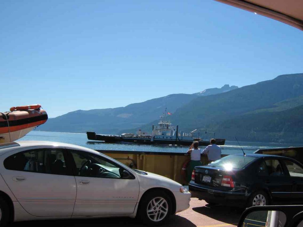
I glassed across the lake from Ainsworth and checked out a nice primitive campground at Eagle bay, but there appeared to be a lot of campers there due to the long weekend. So I drive right on to the Galena Bay ferry without any wait and headed for Revelstoke again. Decided then that I had best not miss the Brent Lee Band playing for the weekend at Wild Bill's in Banff, so I headed there direct with a stop at home in Lake Louise for a shower and clean clothes. Another excursion comes to an end.
No comments:
Post a Comment